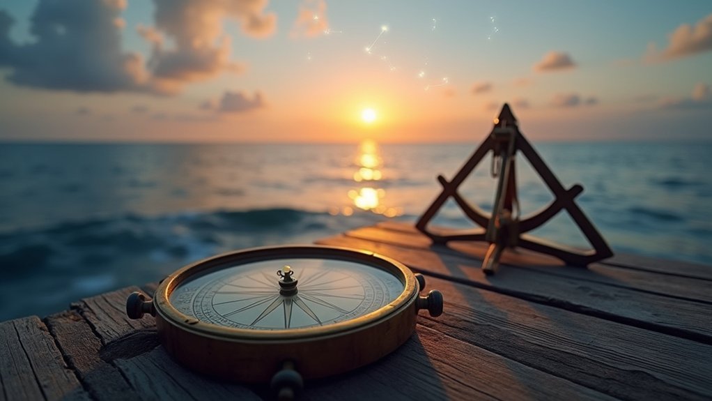
Master your sextant by regularly practicing calibration and proper eye protection techniques. Take advantage of twilight periods when both stars and horizon are visible for ideal sightings. Perfect the noon sight method to accurately determine your latitude without electronic aids. Maintain an up-to-date Nautical Almanac for essential celestial data. Learn to recognize natural navigational signs like Polaris and sun positions as backup references. These timeless skills might save your journey when modern technology fails at sea.
5 Tips For Traditional Celestial Navigation Today

Although modern GPS technology has revolutionized maritime navigation, mastering traditional celestial navigation remains an invaluable skill for any serious sailor.
To improve accuracy, practice taking sun sightings in varying conditions, developing proficiency with your sextant’s index mirror and horizon adjustments.
Practice sun sightings across diverse conditions to master your sextant’s index mirror and horizon adjustments for improved navigational accuracy.
Always carry an up-to-date Nautical Almanac to determine the sun’s declination and precise timing for noon sights. The angle measured during these observations provides essential latitude data, so timing accuracy is crucial.
Use appropriate sight reduction tables for your vessel to convert observed altitude readings into an accurate position. Protect your eyes with proper shades when measuring solar angles.
Maintain a detailed navigation log documenting each celestial observation, including time, readings, and corrections applied. This practice helps track improvements and builds confidence in your traditional navigation skills.
Master Your Sextant: Essential Techniques for Accurate Readings
The sextant serves as the cornerstone of traditional celestial navigation, demanding both proper technique and regular practice.
Begin by properly calibrating your instrument, adjusting the index mirror using the trigger for gross adjustments before fine-tuning with the micrometer drum screw.
When taking a celestial sighting, use appropriate shades to protect your eyes while you measure the angle between a celestial body and the horizon. Bring the celestial body down to meet the horizon for accurate readings.
Always record the exact time of your sight, as precise timekeeping is essential for determining your position on the Earth’s surface.
Remember that even with modern technology, understanding that one minute of arc equals approximately one nautical mile reinforces why readings must be accurate enough for nautical almanacs calculations.
Practice regularly in controlled environments before venturing offshore.
Understanding Twilight Observations for Optimal Visibility

When steering by the stars, twilight offers a unique advantage that experienced sailors treasure: the simultaneous visibility of both celestial bodies and the horizon.
You’ll find nautical twilight—when the sun sits 6° below the horizon—particularly valuable for celestial navigation as stars become visible while the horizon remains discernible.
For ideal conditions, time your sightings carefully. This window lasts just 30-60 minutes depending on your location and season.
Clear skies and minimal light pollution dramatically improve your ability to take accurate measurements with your sextant.
Don’t miss the three twilight phases: civil, nautical, and astronomical. Each presents different visibility challenges and opportunities.
Plan your sightings strategically, aligning celestial bodies with the horizon to achieve the precision needed for traditional navigation methods.
The Art of the Noon Sight: Calculating Your Latitude
While twilight observations offer valuable celestial references, determining your position at midday provides another cornerstone technique in maritime navigation. The noon sight, when the sun reaches its highest point in your sky, gives you a direct reading of your latitude with remarkable accuracy.
To execute this method, begin by consulting your nautical almanac to predict local noon based on your approximate longitude.
Take multiple sextant readings as the sun approaches its zenith. After correcting for index error and height of eye, calculate the zenith distance by subtracting your observed height from 90°.
Then, apply the sun’s declination value—found in your almanac—to this zenith distance. The result is your latitude.
Recognizing Natural Signs to Enhance Your Navigation Skills

Beyond your sextant and charts, nature itself offers abundant navigational clues that can confirm your position or guide you when instruments fail.
In the northern hemisphere, Polaris remains your faithful companion for finding true north—use the Big Dipper to locate this invaluable celestial reference point.
You can navigate using shadows to determine cardinal directions. Place a vertical stick in the ground and mark its shadow before and after solar noon; the line connecting these marks runs east-west.
Watch where the sun rises and sets, while remembering that at local noon, the sun indicates due south in temperate regions.
At night, familiarize yourself with constellations like Orion to orient yourself.
Even the crescent moon offers guidance—its “horns” generally point southward when visible.
The natural world provides reliable backup to formal celestial navigation techniques.
Frequently Asked Questions
Why Is Traditional Celestial Navigation Still Considered Useful and Used Today?
You’ll find celestial navigation useful as it’s a reliable backup when technology fails, connects you to maritime heritage, improves your situational awareness, and deepens your appreciation for the natural world’s patterns.
How to Solve Celestial Navigation?
To solve celestial navigation, you’ll take sextant readings, apply corrections, calculate zenith distance, determine latitude using declination, and plot your position using sight reduction tables and azimuth lines to create a navigational fix.
How Long Does It Take to Learn Celestial Navigation?
You’ll need 20-40 hours to learn basic celestial navigation concepts. With regular practice, you can master simple sun sights in weeks, but full proficiency takes months of consistent practice and hands-on experience.
What Are the Principles of Celestial Navigation?
Celestial navigation centers on your measurement of angles between celestial bodies and the horizon. You’ll calculate your position by comparing observed altitudes with published celestial data, plotting resulting lines on nautical charts.
In Summary
While celestial navigation has ancient roots, it’s still a valuable skill in today’s high-tech world. You’ll find that mastering your sextant, understanding ideal observation times, perfecting the noon sight, and reading nature’s cues creates a reliable backup to modern GPS. Whether you’re a serious mariner or weekend sailor, these traditional techniques won’t just guide you home—they’ll connect you to generations of seafarers who navigated by the stars.


Leave a Reply