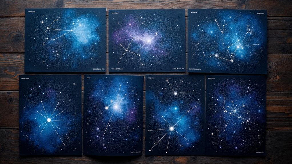
Printable star maps transform complex night skies into manageable guides for your stargazing adventures. You’ll find seven essential formats: monthly all-sky maps tailored to your hemisphere, detailed constellation charts with mythology, magnitude-based maps for varying light conditions, customizable charts for your location, deep sky object guides, adjustable planispheres that rotate for year-round use, and moon/planetary position charts. These affordable, downloadable resources help you confidently identify celestial objects and plan ideal observation sessions under the stars.
Monthly All-Sky Maps for Seasonal Stargazing

Five essential monthly all-sky maps provide your gateway to the ever-changing celestial landscape.
These regularly updated sky maps reflect current visibility conditions, ensuring you’ll always know which stars and constellations dominate your region’s night sky.
Stay current with our regularly refreshed sky maps showing exactly what’s visible in your nighttime celestial neighborhood.
You’ll find these maps specifically tailored for your hemisphere, making it simple to identify prime observation targets regardless of your location.
Whether you’re planning tomorrow’s stargazing session or preparing for next week’s meteor shower, these charts deliver the information you need.
Designed with both newcomers and amateur astronomers in mind, these printable resources offer straightforward guidance for exploring the cosmos.
You can easily access and print these maps online, giving you a reliable reference to carry during your outdoor observations throughout all seasons.
Constellation-Specific Charts for Detailed Exploration
When you’re ready to deepen your knowledge beyond general sky views, constellation-specific charts offer the precision you’ll need for focused celestial exploration.
These detailed maps provide exact R.A. and Dec. coordinates, highlighting the brightest stars with Greek alphabet symbols for easier identification during your stargazing sessions.
You’ll find constellation-specific charts particularly valuable when using binoculars or small telescopes, as they’re designed with naked-eye visibility in mind.
Many charts include the fascinating mythology behind each star pattern, connecting you to ancient storytelling traditions.
- Download printable PDF versions to take with you on field trips
- Use the Greek letter designations to identify magnitude and prominence of key stars
- Match coordinate systems on the charts with your telescope’s settings for precise targeting
Magnitude-Based Star Maps for Different Viewing Conditions

Choosing the right star map for your viewing location makes all the difference between a successful and frustrating stargazing experience.
Magnitude-based star maps are designed specifically for varying light conditions you’ll encounter.
If you’re observing from urban areas with significant light pollution, select maps showing stars brighter than magnitude 4 or 5 for optimal visibility. Under dark skies, you can use charts displaying stars up to magnitude 6, which is typically the naked-eye visibility limit.
For enhanced viewing with optical aids, consider more detailed options. The Mag-7 Star Atlas Project offers extensive charts with stars down to magnitude 7.25 and over 550 Deep Sky Objects.
When using a finder scope, maps showing stars up to magnitude 8 will help you locate fainter celestial objects, expanding your astronomical exploration.
Customizable Star Charts Based on Location and Time
Customizable star charts let you create personalized sky maps that reflect exactly what you’ll see from your specific location, whether you’re in the southern hemisphere or a light-polluted city.
You’ll discover how seasonal variations affect star visibility throughout the year, allowing you to plan ideal viewing sessions for different celestial events.
With time-specific adjustments, you can print charts that accurately represent tonight’s sky or commemorate significant dates like birthdays or anniversaries.
Personalized Sky Viewing
The magic of personalized star charts lies in their ability to capture the exact celestial arrangement visible from your location at any specific moment in time.
You can create custom sky maps that reflect significant dates in your life—birthdays, anniversaries, or other memorable occasions—complete with visible constellations, stars, and planets.
Many online platforms offer user-friendly interfaces where you’ll find it easy to adjust date, location, and design elements for your personalized sky viewing experience.
Add custom messages or titles to make these star charts even more meaningful before printing them as posters or canvas art.
- Transform ordinary moments into cosmic memories
- Connect personally with the universe through your unique celestial snapshot
- Create lasting reminders of nights that hold special significance in your life
Location-Specific Star Patterns
When you gaze at the night sky from different parts of the world, you’ll notice dramatically different celestial views based on your geographic position. This is why location-specific star charts are invaluable for meaningful stargazing experiences.
By entering your exact coordinates into online tools, you’ll generate customized star charts that accurately display constellations, stars, and other celestial objects visible from your specific location. Many resources offer downloadable PDF versions of these personalized maps for convenient printing and outdoor reference.
These customizable charts also reveal how your night sky transforms throughout the year, highlighting seasonal constellation shifts and upcoming astronomical events like meteor showers.
With a location-specific star chart in hand, you’ll more easily identify and navigate the unique celestial panorama above your home, enhancing your connection to the cosmos.
Seasonal Viewing Options
Stargazing becomes even more meaningful when you account for the changing celestial displays throughout the year.
Seasonal star charts allow you to customize your viewing experience based on specific dates and geographic coordinates, ensuring you’re looking at an accurate representation of what’s actually visible from your location.
Platforms like SkyChart and Stellarium offer downloadable, printable maps that adjust for your local time and position, highlighting prominent constellations and celestial events unique to each season.
These charts often include rising and setting times of significant objects, helping you plan your observation sessions effectively.
- Create a personalized connection with the night sky by tracking seasonal changes in visible constellations
- Maximize your viewing opportunities by identifying ideal times for observing specific celestial events
- Build astronomical knowledge progressively by following the sky’s natural seasonal patterns
Deep Sky Object Guides for Amateur Astronomers
What celestial treasures await beyond the familiar stars and planets? Deep sky objects like galaxies, nebulae, and star clusters offer fascinating targets for your astronomical pursuits.
You’ll find extensive resources designed specifically to help you locate and identify these distant wonders. The Mag-7 Star Atlas includes essential Messier objects, while the Deep Sky Hunter provides practical field guides with navigational star maps.
For more detailed exploration, Pretty Deep Maps features over 6,000 charts plotting approximately 117,000 bright stars alongside millions of celestial objects. Don’t overlook Taki’s 8.5 Magnitude Star Atlas, created specifically for deep sky observing with user-friendly features.
These specialized guides transform your stargazing sessions by providing the tools you need to navigate beyond our solar system and discover the universe’s hidden gems.
Printable Planispheres for Year-Round Navigation

You’ll find adjustable star wheels to be invaluable tools that rotate to display the visible constellations for any date and time throughout the year.
Northern and southern hemisphere-specific versions guarantee you’re using a planisphere tailored to your exact viewing location, improving your navigation accuracy.
These printable guides typically include clear instructions for assembly and use, allowing you to quickly identify celestial objects regardless of the season.
Adjustable Star Wheels
When the night sky presents its vast canvas of stars, having a reliable navigation tool becomes essential for both novice and experienced astronomers. Adjustable star wheels, or planispheres, offer a customizable solution that adapts to your specific viewing conditions throughout the year.
These printable devices rotate to match any date and time, instantly revealing which constellations you’ll see in your location. You’ll find versions designed for Northern, Southern, and Equatorial Hemispheres, making them versatile for stargazers worldwide.
- Print on standard paper to create an accessible guide that fits in your pocket
- Develop navigation skills by identifying seasonal patterns in celestial movements
- Enhance your educational experience by visualizing how Earth’s rotation affects visible stars
Simply rotate the wheel to align with current conditions, and you’ve opened up a personalized map to the cosmos.
Hemisphere-Specific Versions
Because the stars visible in the night sky differ dramatically depending on your global position, hemisphere-specific planispheres have become essential tools for accurate celestial navigation. You’ll find these specialized star charts updated monthly to reflect current celestial positions, making them invaluable for year-round skygazing.
| Planisphere Type | Key Features |
|---|---|
| Northern Hemisphere | Polaris-centered, includes Big Dipper |
| Equatorial | Shows both celestial poles, widest coverage |
| Southern Hemisphere | Southern Cross-centered, Magellanic Clouds |
| Universal | Adjustable for different latitudes, basic details |
Simply match the current date and time on your printable planisphere to align with what’s actually overhead. You can download and print these hemisphere-specific charts at home, providing an affordable way to explore the night sky from your specific location.
Moon Phase and Planetary Position Charts
While stars remain relatively fixed in their positions, the moon and planets follow predictable paths across our night sky.
The eternal dance of our cosmic neighborhood—stars standing still while planets and our moon gracefully traverse the heavens above.
Printable moon phase charts reveal the lunar cycle’s progression throughout the month, helping you plan observations based on moonlight conditions. Similarly, planetary position charts show exactly where to find Mars, Jupiter, Saturn, and others among the constellations at specific times.
These complementary tools enhance your star charts and improve your stargazing experience:
- Carry printable versions during night sessions to quickly identify ideal viewing periods for celestial events
- Use moon phase information to determine when faint objects will be most visible without lunar interference
- Track planetary movements to witness special alignments and conjunctions that occur only at specific intervals
Frequently Asked Questions
Where Can I Download Star Maps?
You can download star maps from the Mag-7 Star Atlas Project, Taki’s 8.5 Magnitude Star Atlas, the TriAtlas Project, or the Deep Sky Hunter Star Atlas. They’re all free and printable.
What Is the Best Free Star Map App?
Stellarium is the best free star map app you’ll find. It offers realistic sky simulation on both desktop and mobile. Other great options include SkySafari Lite, Sky Map, Star Walk 2, and Heavens-Above.
How to Generate a Star Map?
You’ll need to select a date, time, and location in a star map app like Stellarium or SkyChart. Input these parameters, and the software will generate your personalized view of the night sky.
How Do I Find My Star Map?
You’ll find your star map by visiting Skymaps.com for monthly charts tailored to your hemisphere, downloading Johnson’s detailed PDFs, or using interactive options like Stellarium Web that adjust to your specific location.
In Summary
With these seven printable star maps, you’re fully equipped to navigate the night sky like a seasoned astronomer. Whether you’re tracking seasonal constellations, focusing on specific star patterns, or hunting for deep sky objects, you’ll always have a reliable guide at your fingertips. Don’t let changing conditions or locations deter you—just print what you need, step outside, and let the universe unfold above you.


Leave a Reply