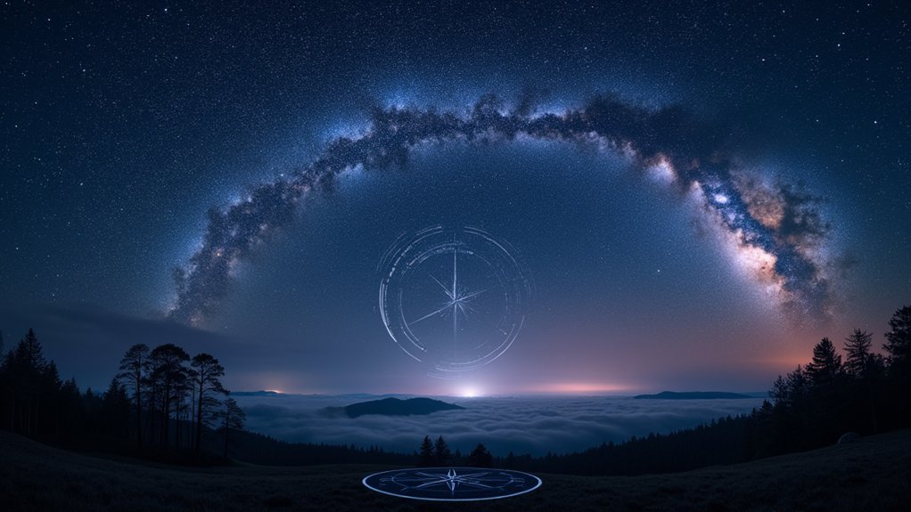
A perfect night sky navigation guide balances basic star identification with advanced calculation techniques. You’ll need coverage of essential constellations like the Big Dipper and Southern Cross, seasonal pattern recognition, and practical methods for finding true north. Effective guides address both hemisphere-specific techniques and universal principles, while including strategies for overcoming light pollution and weather challenges. The best resources also incorporate moon phases and simple tools to enhance your navigation capabilities. These core elements form your pathway to celestial wayfinding mastery.
Numeric List of 12 Second-Level Headings

Twelve essential techniques comprise our night sky navigation guide. Each heading represents a critical skill you’ll master to navigate using the stars confidently. The sequence progresses logically from basic identification to advanced calculations.
First, you’ll learn celestial body recognition, followed by compass direction determination. Next, we cover latitude calculation and hemisphere identification.
The fifth and sixth headings address seasonal sky changes and using the North Star effectively. You’ll then explore lunar phase navigation and planetary motion tracking.
The final sections cover navigation tools including sextants and star charts, celestial timing methods, cloud cover workarounds, and emergency navigation techniques.
Essential Constellations for Directional Orientation
Whether you’re in the Northern Hemisphere or Southern Hemisphere, certain constellations serve as reliable celestial signposts to determine your cardinal directions.
In the northern sky, you’ll find the Big Dipper and Cassiopeia working as complementary guides that point toward Polaris, establishing true north for navigation.
Southern sky travelers can rely on the distinctive Southern Cross constellation and the pointer stars Alpha and Beta Centauri to accurately locate south when traditional compass methods aren’t available.
Key Northern Constellations
When you’re lost under the night sky, several prominent northern constellations become your reliable celestial guides. The most critical formation is the Big Dipper, whose two end stars, Dubhe and Merak, help you navigate directly to the North Star (Polaris).
Simply draw an imaginary line extending from these pointer stars about five times their distance apart. Polaris remains fixed in the northern sky, making it your unwavering reference point for finding true north.
If clouds obscure the Big Dipper, look for Cassiopeia’s distinctive W-shape on the opposite side of Polaris. This constellation serves as an alternative pathway to locate the North Star.
Together with Orion’s Belt, which indicates east-west orientation, these northern constellations provide a complete directional framework for nighttime navigation.
Southern Sky Wayfinding
Unlike the northern sky with its convenient North Star, navigators in the Southern Hemisphere must rely on a different set of celestial landmarks. The Southern Cross constellation serves as your primary guide, with its distinctive cross-shaped pattern of four bright stars pointing toward the south celestial pole.
To find true south, identify the cross and locate the pointer stars Alpha and Beta Centauri. Draw an imaginary line through these two stars and extend it down to the horizon. As the night progresses, the Southern Cross rotates around the pole, so you’ll need to adjust your calculations accordingly.
For thorough celestial navigation, familiarize yourself with neighboring constellations like Centaurus and Carina. These additional reference points will enhance your orientation abilities and help you determine time throughout the southern night sky.
Finding True North With Polaris and the Big Dipper

Navigators throughout history have relied on Polaris, the North Star, as their celestial compass. You’ll find this reliable nighttime guide at the end of the Little Dipper’s handle, remaining fixed while other stars rotate around it.
To locate Polaris in the night sky:
- Find the Big Dipper constellation first
- Identify the two “pointer stars” at the outer edge of the Big Dipper’s bowl
- Follow this line approximately five times the distance between these pointers
The height of Polaris above your horizon equals your latitude on Earth—a simple yet powerful navigational tool.
As the Big Dipper and Cassiopeia rotate around Polaris throughout the night, they create a dependable reference system that works regardless of season, allowing you to establish true north without any instruments.
Southern Hemisphere Navigation Using the Southern Cross
While Polaris guides travelers in the Northern Hemisphere, those below the equator rely on a different celestial landmark. The Southern Cross, or Crux, serves as your key to finding true south when exploring the southern skies.
To navigate using this distinctive constellation, locate the four bright stars forming the cross shape. Draw an imaginary line along the long axis of the Southern Cross toward the horizon—this points to the south celestial pole.
For greater precision, use Alpha and Beta Centauri (the “Pointer Stars”) to create a second reference line. The nearby Centaurus constellation provides additional reference points to verify your bearings.
Watch the Southern Cross at different times throughout the night to understand its rotation, improving your ability to accurately determine true south in any conditions.
Seasonal Star Patterns Throughout the Year

The night sky transforms dramatically with each passing season, offering a rotating celestial showcase for observers and navigators alike. While the North Star remains your constant companion year-round, the surrounding seasonal star patterns shift predictably as Earth orbits the Sun.
Your viewing location greatly impacts what you’ll see:
- Spring reveals Leo and Virgo dominating evening skies, perfect for beginning your stargazing year.
- Summer brings the distinctive Summer Triangle overhead, while winter showcases magnificent Orion.
- Autumn features Pegasus and Andromeda, completing your year-round celestial journey.
Using a star chart or app helps you track these changes regardless of your hemisphere—northern observers enjoy Ursa Major, while southern stargazers rely on the Southern Cross.
These seasonal patterns provide reliable navigation references beyond the steadfast North Star.
Measuring Latitude Using Star Angles
Determining your exact position on Earth requires just two celestial measurements: longitude and latitude. The North Star (Polaris) offers a remarkably simple way to measure latitude in the Northern Hemisphere. Your latitude in degrees north equals the angle of Polaris above the horizon.
| Tool | Accuracy | Best Use Case |
|---|---|---|
| Sextant | High | Maritime navigation |
| Kamal | Medium | Traditional sailing |
| Astrolabe | Medium | Historical method |
| Outstretched fist | Low | Emergency situations |
| Smartphone app | High | Modern convenience |
When you’re north of the equator, simply locate Polaris and measure its angle above the horizon. At 30° elevation, you’re at 30°N latitude. The lower Polaris appears, the further south you are. Once Polaris disappears below the horizon, you’ve crossed the equator.
Key Visual Aspects: Brightness, Color, and Star Relationships

When steering by stars, you’ll need to recognize brightness levels using the magnitude scale, where lower numbers indicate brighter stars that remain visible even in less-than-ideal conditions.
The color of stars isn’t just beautiful—it’s functional, as you can classify stars by their temperature (blue being hottest, red coolest) to confirm you’re looking at the right celestial marker.
Learning to quickly identify distinctive star patterns called asterisms, like the Big Dipper within Ursa Major, will dramatically improve your ability to orient yourself regardless of your location or time of night.
Magnitude Visibility Standards
Stars reveal their secrets through visual characteristics you’ll learn to interpret quickly with practice. The magnitude scale measures a star’s brightness—remember that lower numbers indicate brighter stars. You’ll find magnitude 1 stars easily even in light-polluted areas, while magnitude 6 stars require darker skies.
When guiding by stars, keep these visibility standards in mind:
- First-magnitude stars serve as your primary reference points and remain visible in most conditions
- Blue stars (hotter) versus red stars (cooler) help you identify star types without equipment
- Stars in familiar constellations like the Big Dipper maintain consistent relationships, allowing you to gauge direction regardless of season
Under ideal conditions, you’ll see stars beyond magnitude 6, but focusing on brighter stars guarantees reliable navigation even when conditions aren’t perfect.
Color-Temperature Star Classification
The spectrum of stellar colors reveals a universe of information for night sky navigators. When you’re scanning the heavens, you’ll notice stars aren’t simply white dots—they range from brilliant blue to fiery red.
This color variation directly reflects a star’s surface temperature: blue stars burn hottest at over 30,000 Kelvin, while red stars operate at a cooler 2,500 Kelvin.
Your navigation skills improve when you understand that a star’s color tells its story. Blue stars are typically younger and more massive, while red stars are often ancient celestial elders.
Our yellow Sun falls between these extremes. By recognizing these color-temperature relationships, you’ll identify key reference points more easily and position yourself confidently using the Hertzsprung-Russell patterns that organize the cosmos into navigable sections.
Asterism Familiarization Techniques
Beyond understanding star colors, mastering the night sky requires recognizing distinctive patterns called asterisms. These stellar groupings serve as your roadmap for navigation, with each pattern offering unique visual cues:
- Brightness variations – Stars within asterisms like Orion’s Belt feature distinct luminosities that make them recognizable even in less-than-ideal conditions.
- Color distinctions – Notice the reddish Betelgeuse versus blue-white Rigel in Orion to quickly orient yourself.
- Positional relationships – Learning the angles and distances between stars helps you locate critical reference points like Polaris.
As you practice identifying these patterns, you’ll observe how asterisms rotate predictably around fixed celestial points throughout the night.
This rotation provides valuable information for both timekeeping and navigation, allowing you to establish direction even when other reference points are unavailable.
Practical Tools for Star Identification

Charting the night sky becomes considerably easier when you’re equipped with the right tools for star identification. Star charts serve as your fundamental reference, helping you locate constellations and the North Star for accurate direction finding.
Augment these traditional tools with modern smartphone apps that use augmented reality to overlay celestial information directly onto your view of the night sky.
Don’t underestimate the value of quality optics. Binoculars or a portable telescope will reveal fainter stars and details invisible to the naked eye, enhancing your navigation capabilities.
While learning to recognize key constellations like the Big Dipper and Cassiopeia, keep a compass handy to confirm your directional readings. This combination of traditional and technological tools creates a reliable system for accurately identifying celestial bodies and maintaining your course.
Estimating Direction Without Special Equipment
When you’re lost without a compass, you can rely on the night sky’s natural signposts to find your way.
Locate Polaris using the Big Dipper’s pointer stars to establish true north, or track Orion’s belt as it travels from east to west across the heavens.
The crescent Moon offers another quick reference, with its “horns” pointing south when visible above the horizon.
Finding North Naturally
Although modern navigation tools have become commonplace, knowing how to find direction using only the night sky remains an essential skill for any outdoor enthusiast.
To navigate by the stars, finding the North Star (Polaris) is your most reliable method as it maintains a fixed position above the North Pole.
You can easily find the North Star by:
- Locating the Big Dipper and using its two outer stars as pointers—Polaris sits about five times that distance away
- Observing Polaris’s height above the horizon, which directly matches your latitude
- Using Cassiopeia as a confirmation point, as it sits opposite the Big Dipper from Polaris
The brighter stars offer better reference points when determining cardinal directions.
Remember that Polaris remains stationary while other stars appear to rotate around it throughout the night.
Quick Direction Estimation
What if you find yourself under a clear night sky without a compass or GPS? You can still navigate with remarkable accuracy using celestial objects. To find true north, locate the Big Dipper and measure five times the distance between its pointer stars to find Polaris, the North Star.
| Celestial Guide | Direction Indication |
|---|---|
| North Star (Polaris) | Directly north; height equals your latitude |
| Orion’s Belt (Mintaka) | Rises and sets near true east and west |
| Star Movement | Ascending = east; Descending = west |
Watch stars move across the sky to confirm your bearings. If you can identify Cassiopeia (opposite the North Star), you’ll have an additional reference point. Remember that your fist width held at arm’s length equals roughly 10 degrees, helping you estimate angles and latitude without instruments.
Star Patterns Simplified
Even with no tools at your disposal, you can establish reliable directions using simple star pattern recognition techniques. The night sky offers consistent navigational patterns that remain reliable year-round.
To find true north, locate the Big Dipper and follow its two pointer stars to the North Star (Polaris). The horizon point directly below Polaris marks true north. Your latitude equals the angle between Polaris and the horizon, measurable using your fist (approximately 10 degrees).
- Using Orion’s belt’s three-star alignment helps identify east and west, as it rises in the east and sets in the west.
- Find your direction by observing star movement patterns—all stars rise in the east and set in the west.
- Measure celestial angles with your outstretched fist, creating a natural 10-degree measuring tool.
Overcoming Weather and Light Pollution Challenges
Despite our best planning efforts, successful night sky navigation often hinges on your ability to adapt to environmental conditions beyond your control.
To minimize light pollution‘s impact, position yourself away from urban centers where artificial lighting drowns out fainter stars vital for navigation. You’ll notice dramatically improved visibility of constellations and reference points in rural settings.
Monitor weather forecasts vigilantly before planning your stargazing expedition. Low humidity, minimal cloud cover, and clear skies are essential for ideal visibility. If possible, schedule your navigation practice during the new moon phase when moonlight won’t overwhelm dimmer celestial bodies.
Remember to bring a red flashlight rather than a standard white one. This simple tool preserves your night vision while allowing you to check maps or equipment without disrupting your eyes’ adaptation to darkness.
Regional Adaptations for Different Latitudes
As you venture across different parts of the globe, your celestial navigation techniques must adapt to the changing night sky panorama visible from each latitude.
In the Northern Hemisphere, finding Polaris offers an instant fix on true north, with its angle above the horizon conveniently matching your latitude in degrees.
Southern Hemisphere travelers face different challenges, requiring familiarity with the Southern Cross for direction using its imaginary alignment to locate south.
- At higher northern latitudes, Polaris becomes more prominent and sits higher in the sky.
- Within tropical regions, you’ll need seasonal star pattern recognition as both hemispheres’ constellations become visible.
- In southern regions, learn to use bright stars like Sirius and the Southern Cross when Polaris disappears below the horizon.
Incorporating Moon Phases Into Navigation Strategy
While celestial navigation by stars varies across latitudes, the Moon offers a constant presence in both hemispheres, making it an invaluable navigation tool.
Different moon phases provide varying levels of illumination—full moons offer bright light for nighttime wayfinding, while crescents provide subtle directional cues.
You’ll find a full moon at its highest point indicating south in the Northern Hemisphere, giving you a reliable reference point.
Watch for the crescent moon’s horns, which point southward when above the horizon, helping you orient yourself even in dim conditions.
Track the Moon’s position relative to constellations to determine both time and direction.
Remember that the Moon follows the Sun’s general path, rising in the east and setting in the west—knowledge that becomes essential when other navigation methods fail.
Frequently Asked Questions
What Are the Basics of Celestial Navigation?
You measure angles between celestial bodies and the horizon using a sextant. You’ll need star charts, accurate timekeeping, and knowledge of Polaris. Calculate your latitude and longitude by comparing local time with Greenwich time.
What Are the Best Stars for Celestial Navigation?
For celestial navigation, you’ll rely primarily on Polaris (North Star) in the northern hemisphere and the Southern Cross in the southern hemisphere. Bright stars like Sirius and constellation markers such as Orion’s Belt are also invaluable guides.
How Did Navigators Use the Night Sky?
You’d find Polaris using the Big Dipper’s pointer stars, measure its angle for latitude, track Orion’s belt for direction, and use the Southern Cross in southern waters. Stars were your reliable, ever-present GPS.
How Is the Night Sky Mapped?
The night sky’s mapped using celestial coordinates like right ascension and declination. You’ll find stars organized into 88 official constellations on the celestial sphere, while modern catalogs provide precise stellar positions for your navigation needs.
In Summary
You’ll find that mastering night sky navigation isn’t about memorizing every star—it’s about understanding key patterns that remain reliable regardless of your location or conditions. With regular practice identifying the essential constellations, adapting techniques to your hemisphere, and accounting for seasonal changes, you’ll develop an intuitive sense of direction that works even when technology fails. The perfect guide balances technical precision with practical application.


Leave a Reply