
To read star maps effectively, align your chart with cardinal directions and hold it overhead. Identify bright stars as reference points and use familiar constellations like the Big Dipper for orientation. Understand magnitude scale and celestial symbols (⊕ for globular clusters, ⊛ for open clusters). Match time coordinates with your viewing time and adjust for daylight savings. Learn star hopping techniques to locate deep sky objects. Master declination and right ascension for precise navigation. These fundamentals will transform your stargazing journey.
7 Essential Tips For Reading Star Maps
When venturing into the world of amateur astronomy, knowing how to read a star map correctly can transform your stargazing experience. Hold your star map overhead with cardinal directions properly aligned to navigate the night sky effectively.
Start by identifying the brightest stars on your monthly star charts—they appear as larger dots and serve as essential reference points. Use familiar constellations like the Big Dipper to orient yourself and locate various celestial objects.
Remember that while patterns may appear larger in the actual sky than on your map, stars maintain constant relative positions, making your chart reliably consistent.
For best results, practice under dark skies where more stars are visible. With time, you’ll develop the ability to mentally translate between the two-dimensional map and the three-dimensional dome above you.
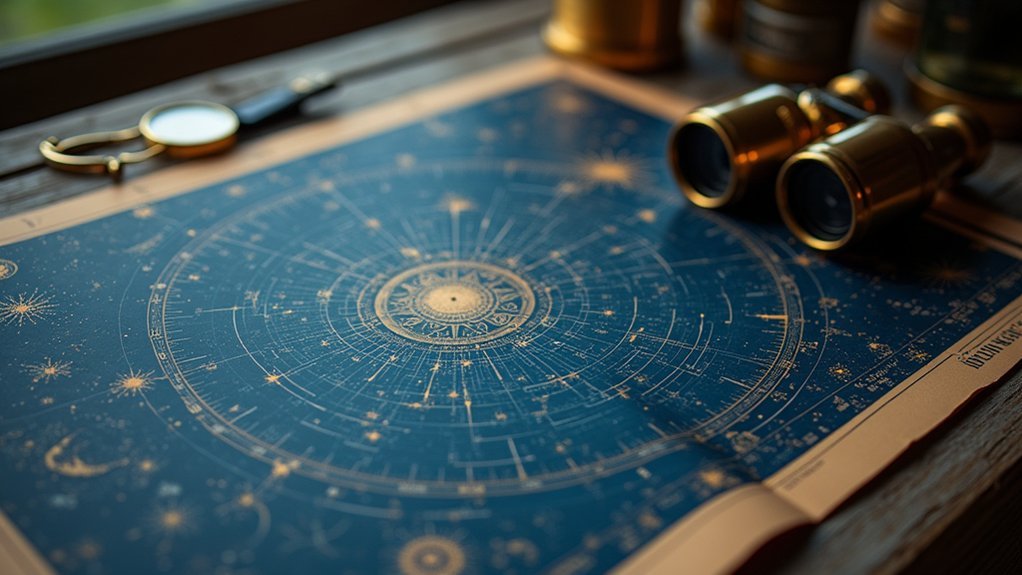
Understanding Star Chart Symbols and Magnitudes
A star chart’s true power lies in its symbolic language. When you’re deciphering these celestial maps, notice how brighter stars appear as larger dots, making them easier to spot during your stargazing sessions. The magnitude scale assigns lower numbers to brighter stars—a first-magnitude star shines considerably brighter than a sixth-magnitude one.
| Symbol | Represents | Finding Tip |
|---|---|---|
| ⊕ | Globular Clusters | Look for spherical collections |
| ⊛ | Open Star Clusters | Seek loosely grouped stars |
| ○ | Galaxies | Find fuzzy patches of light |
| □ | Nebulae | Search for cloudy regions |
| ~ | Variable Stars | Monitor brightness changes |
Pay attention to these special symbols that indicate different celestial objects like clusters, galaxies, and nebulae. Variable stars have dedicated markings to show their changing brightness, helping you track their fascinating fluctuations over time.
Orienting Your Chart to Match the Night Sky

For successful stargazing, you’ll need to hold your star chart overhead and align its North position with the actual northern horizon.
You should rotate the chart to match the current time coordinates displayed on the outer rim with your viewing time.
Your chart will only work properly when it’s oriented correctly relative to your viewing direction, whether you’re facing North, South, East, or West.
Align North Properly
The single most important step in using a star chart effectively is properly aligning it with the night sky. To align north properly, hold your star chart above your head with the cardinal directions matching the actual sky orientation.
First, locate the North Star (Polaris) at the end of the Little Dipper’s handle. This fixed point will help you determine true north. The Big Dipper serves as an excellent reference point—follow its outer edge to find Polaris.
Once you’ve established north, adjust your star chart so the north edge points in that direction. When facing south for stargazing, confirm the southern horizon on your chart aligns with the horizon at your feet. This orientation confirms celestial objects on your chart directly correspond to their positions in the night sky.
Match Time Coordinates
Once you’ve aligned north correctly, matching time coordinates becomes your next critical step for accurate stargazing. With a planisphere, rotate the chart until the current date aligns with the time you’re observing. Remember to adjust for Daylight Savings Time to guarantee proper alignment with the night sky.
Your planisphere must match your latitude for accurate star visibility. For easier reference, monthly charts eliminate the need for time adjustments, making them ideal for beginners.
When using either tool, hold the chart overhead with cardinal directions properly oriented to match what you see above.
This time-coordinate matching transforms your star map from a confusing jumble of dots to a precise navigational tool that reveals which celestial objects should be visible from your specific location at that exact moment.
Rotate For Viewing
Properly orienting your star chart transforms your stargazing experience from confusion to clarity. Hold the chart above your head and align it with cardinal directions—north on your chart should face actual north. If you’re using a planisphere, rotate the movable disc to match the current date and time.
| Position | On Chart | In Sky | How to Identify |
|---|---|---|---|
| Center | Zenith | Directly overhead | Point straight up |
| Edges | Horizon | Where sky meets earth | Look straight ahead |
| North | Top of chart | Find Polaris | Use compass or landmarks |
| Current view | Visible section | Tonight’s stars | Rotate to current time |
Remember that your latitude matters—use a star chart designed for your geographical location. The night sky appears differently depending on where you stand on Earth. By properly orienting your chart, the stars above will directly correspond to what you see.
Using Cardinal Directions for Proper Alignment

Four key cardinal directions serve as your essential compass when aligning a star chart with the night sky. When you’re ready to stargaze, hold your chart overhead with North positioned at the top, creating an exact match with the celestial panorama above you.
- Find your North Star (Polaris) using the Big Dipper as your guide – this celestial anchor helps you establish true North and properly orient your entire chart.
- When facing South, position the Southern Horizon at your feet on the star chart to easily locate constellations in that direction.
- Reference the cardinal directions marked along your chart’s edge for quick navigation as you scan the heavens.
- Maintain proper alignment throughout your observation session to accurately identify celestial objects and experience the wonder of correct constellation identification.
Mastering Celestial Coordinates: Declination and Right Ascension
The celestial coordinate system uses declination and right ascension to help you pinpoint objects in the night sky—think of them as the space equivalent of latitude and longitude.
You’ll find declination measured in degrees north or south of the celestial equator (from +90° at the north celestial pole to -90° at the south), while right ascension runs in hours from 0 to 24, starting at the vernal equinox.
When you’re searching for specific stars like Sirius, you’ll need both coordinates—Sirius sits at -16° 42′ 58″ declination and 06h 45m 09s right ascension—enabling you to locate it precisely on your star chart.
Celestial Grid Basics
While Earth uses latitude and longitude to pinpoint locations, the night sky operates on a different system known as celestial coordinates. This system maps the celestial sphere using declination (Dec) and right ascension (RA) to help you find stars and deep-sky objects with precision.
- Declination works like latitude, measured in degrees from +90° (North Celestial Pole) to -90° (South Celestial Pole), giving you a sense of an object’s “height” in the sky.
- Right ascension functions as celestial longitude but uses hours (0-24h) instead of degrees, creating a time-based coordinate that aligns with Earth’s rotation.
- Coordinates combine to create unique celestial addresses (like Sirius: RA 06h 45m 09s, Dec -16° 42′ 58″).
- Star charts become navigable maps once you grasp these coordinates, transforming abstract dots into accessible cosmic treasures.
Coordinates For Stargazing
Now that you understand the celestial grid framework, let’s explore how to apply these coordinates practically when stargazing.
When you’re trying to locate objects in the night sky, you’ll use two primary coordinates: declination and right ascension.
Declination works like Earth’s latitude, measuring positions north (+) or south (-) of the celestial equator in degrees. Its range spans from +90° at the North Celestial Pole to -90° at the South Celestial Pole.
Right ascension functions as your celestial longitude, measured in hours (0-24) eastward from the vernal equinox. For example, to find Sirius, you’d look for coordinates 06h 45m 09s right ascension and -16° 42′ 58″ declination.
Mastering these astronomical coordinates transforms your stargazing experience, allowing you to efficiently pinpoint and track celestial objects throughout the night.
Star Hopping Techniques for Locating Deep Sky Objects

Finding elusive deep sky objects requires more than random scanning of the night sky. Star hopping offers a methodical approach using bright stars as stepping stones to guide your telescope toward fainter celestial wonders. By mastering this technique, you’ll transform your stargazing experience from frustrating to fulfilling.
Star hopping transforms the frustrating hunt for deep sky treasures into a methodical journey among the stars.
- Start with familiar constellations – Use these celestial signposts to orient yourself before venturing into less charted territory.
- Trace pathways from bright stars – Mentally draw lines connecting reference stars that lead to your deep sky target.
- Practice regularly to build confidence – Your observational skills will improve with each session.
- Use detailed star charts – Select maps that clearly show the relationship between bright stars and nearby DSOs.
Selecting the Right Star Chart for Your Location and Season
Three key factors determine the effectiveness of your star chart: your geographical location, the current season, and time of night.
When selecting star charts, always verify they match your latitude, as star visibility varies considerably depending on your position on Earth.
For year-round stargazing, choose an all-year planisphere that you can adjust by rotating to match the current date and time, revealing the night sky directly overhead.
Remember to account for Daylight Savings Time adjustments to maintain accuracy.
If you prefer simplicity, monthly sky charts require no recalibration during their valid period.
Alternatively, seasonal charts offer specialized views optimized for specific times of year.
The right chart will transform your stargazing experience by eliminating confusion and helping you navigate the celestial landscape with confidence.
Frequently Asked Questions
How to Read a Star Map for Beginners?
To read a star map, you’ll need to align the map with cardinal directions overhead, look for bright stars (larger dots), use known constellations for orientation, adjust your planisphere for date/time, and identify objects using patterns.
How to Use a Starmap?
Hold your star map overhead, aligning it with actual directions. Identify bright stars first, then use them to locate unfamiliar objects. You’ll need to match the map’s time and date to your viewing session.
Why Are East and West Reversed on a Star Map?
East and west appear reversed on star maps because you’re viewing the sky from below. When you hold the map overhead, it naturally aligns with the celestial sphere, showing stars rising in the east and setting in the west.
How Do I Start Reading the Stars?
You’ll start by learning a few bright constellations like the Big Dipper or Orion. Hold your star chart overhead, align north correctly, and use prominent stars as reference points to navigate the night sky.
In Summary
Mastering star maps will open up the cosmos to your curious eyes. You’ll soon find yourself traversing the night sky with confidence, recognizing constellations instantly, and locating elusive celestial objects. Remember to practice regularly as seasons change the visible patterns overhead. With these seven essential techniques in your astronomical toolkit, you’re well-equipped for a lifetime of stargazing adventures. Happy exploring!


Leave a Reply