
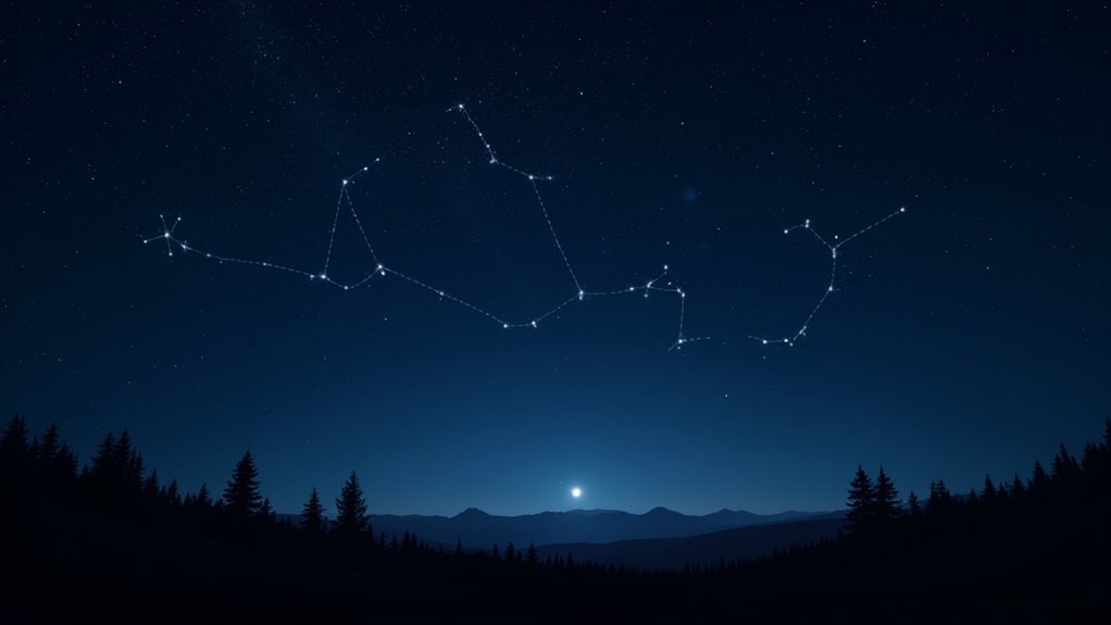
Celestial navigation uses stars and constellations to determine your position and direction without technology. In the Northern Hemisphere, find Polaris (North Star) using the Big Dipper in Ursa Major or Cassiopeia as guides. Southern Hemisphere navigators rely on the Southern Cross (Crux) to locate south. You’ll need basic equipment like a sextant and almanac, but can practice with simple techniques like measuring angles with your fist. These ancient methods still offer reliable backup when modern systems fail.
What Makes Celestial Navigation Timeless

While modern technology offers countless navigational tools, celestial navigation remains remarkably relevant even in today’s digital world. When your GPS fails or batteries die, this ancient skill provides essential redundancy, requiring no electricity or external systems to function.
You’ll gain a profound sense of self-reliance knowing you can determine your position anywhere on Earth using only the sky above. Learning to navigate by stars builds the same confidence and resourcefulness that ancient Polynesians relied upon during their extensive Pacific voyages. Whether you’re sailing across oceans or hiking remote wilderness, celestial navigation works globally regardless of your location.
Beyond practicality, practicing celestial navigation connects you to maritime traditions that guided explorers for centuries. It’s not merely a backup system but a living heritage skill that enhances your understanding of astronomy, mathematics, and navigation principles while fostering problem-solving abilities that serve you in any environment.
The History of Constellation-Based Navigation
Long before the invention of sophisticated instruments, ancient mariners gazed at the night sky to chart their courses across vast oceans and deserts.
The Minoans were among the first to employ celestial bodies for navigation, aligning their structures with astronomical events.
When you read Homer’s *Odyssey*, you’ll find Calypso guiding Odysseus using Ursa Major and the Pleiades, reflecting real navigational practices of the time. Finding and using the North Star (Polaris) was particularly important for early sailors as it provided a consistent reference point for determining direction.
Essential Constellations for Northern Hemisphere Navigation

Five key constellation patterns serve as the backbone of celestial navigation in the Northern Hemisphere. Ursa Major and Ursa Minor are visible year-round, with the Big Dipper’s pointer stars directing you to Polaris—your most reliable celestial landmark.
For millennia, Northern Hemisphere navigators have relied on Ursa Major’s steadfast guidance to locate Polaris—nature’s own directional beacon.
This North Star marks true north when you draw an imaginary line to the horizon. Cassiopeia‘s distinctive W or M shape serves as another circumpolar reference point, appearing opposite Polaris across the celestial pole.
For seasonal navigation, look for Orion in winter, Leo in spring, and the recognizable Square of Pegasus from August through December. The Great Square of Pegasus covers 1121 square degrees of the night sky, making it the seventh-largest constellation and easily identifiable. The latter helps identify surrounding constellations and establish orientation.
With traditional tools like sextants or modern apps, you’ll find these celestial patterns transform the night sky into your natural compass.
Key Southern Hemisphere Star Patterns for Wayfinding
Unlike the Northern Hemisphere with its reliable Polaris, navigators south of the equator must rely on different celestial markers. The Southern Cross (Crux) serves as the primary navigation tool, visible year-round beyond 35° south latitude.
When you’re in the Southern Hemisphere, remember that stars appear to move clockwise across the night sky, opposite to northern patterns. To accurately determine the south celestial pole, extend a line from Gacrux through Acrux and find where it intersects with a perpendicular line from the Alpha and Beta Centauri pointer stars.
| Constellation | Navigation Use | Best Visibility |
|---|---|---|
| Crux | Points toward south celestial pole | Year-round below 35°S |
| Centaurus | Pointer stars help locate south | Higher southern latitudes |
| Eta¹ Doradus | Aids in orientation | Southern night skies |
| Sigma Octantis | Southern “pole star” (dim) | Circumpolar in far south |
| Alpha Centauri | Part of pointer star system | Most visible at higher latitudes |
How to Identify the North Star and Its Significance
Finding Polaris is simple if you can spot the Big Dipper‘s two pointer stars, which create a line directly to this celestial anchor that remains steady while other stars rotate around it.
You’ll rely on Polaris to determine true north and your latitude in the northern hemisphere, making it invaluable for navigation without modern tools.
If you’re in the southern hemisphere where Polaris isn’t visible, you’ll need to use alternative celestial markers like the Southern Cross constellation for similar wayfinding purposes. For situations when Polaris or familiar constellations are obscured, you can navigate by observing the star movement across the sky over time.
Locating Polaris Efficiently
While steering by the stars, Polaris stands as one of the most valuable celestial guides for travelers in the Northern Hemisphere.
To find it efficiently, you’ll need to employ one of three reliable methods.
The most common approach uses the Big Dipper‘s pointer stars, Dubhe and Merak. Draw an imaginary line extending about five times their distance to reach Polaris.
If the Big Dipper isn’t visible, use Cassiopeia‘s V-shape by drawing a line from its middle point.
Alternatively, locate the Little Dipper directly, with Polaris at its handle’s end. When you’ve found Polaris, you’ll know you’re facing true North in the Northern Hemisphere.
Practical Navigation Applications
For thousands of years, Polaris has served as humanity’s steadfast guide through darkness and uncertainty. Though not the brightest star in the sky, its fixed position makes it invaluable for navigation.
To find Polaris, locate the Big Dipper and trace a line through its two outer stars of the “cup” – they’ll point directly to it. Alternatively, use Cassiopeia’s middle star when the Big Dipper isn’t visible. The Little Dipper, also known as the Drinking Gourd, was a powerful symbol in the Underground Railroad.
Once you’ve identified Polaris, you’ve found true north.
The height of Polaris above the horizon roughly equals your latitude in degrees. This technique helped sailors cross oceans, explorers traverse continents, and even guided escaped slaves northward to freedom via the Underground Railroad.
Today, understanding celestial navigation still provides a reliable backup when modern technology fails.
Southern Hemisphere Alternatives
Unlike travelers in the Northern Hemisphere, Southern Hemisphere voyagers can’t rely on Polaris as their celestial guide. The South Celestial Pole has no bright star comparable to the North Star, requiring different navigation techniques.
Instead, you’ll use Crux (Southern Cross) as your primary reference. Locate this distinctive constellation, then draw an imaginary line from its brightest stars toward the horizon to find south. Alternatively, extend four times the length of Crux to identify the South Celestial Pole.
The Southern Cross rotates around this pole and remains visible year-round from latitudes south of about 35°. Centaurus provides additional reference points to complement your navigation. For precise direction finding, drawing an imaginary line between Alpha and Beta Centauri will help point toward the south.
While Sirius will eventually become a South Pole star, it won’t align properly for thousands of years.
Seasonal Changes in Navigational Constellations
You’ll notice different navigational constellations throughout the year as Earth’s axial tilt and orbital position change which stars are visible at night.
In the Northern Hemisphere, the Big Dipper and Cassiopeia work as reliable year-round markers that point to Polaris, even as seasonal constellations like Orion appear and disappear. Practice with star charts or apps can significantly enhance your ability to identify these constellations across different seasons.
Southern Hemisphere navigators rely on the Southern Cross to find south, using the constellation’s long axis to create an imaginary line extending approximately 4.5 times its length toward the horizon.
Northern Hemisphere Markers
The northern sky presents five primary constellations that serve as reliable markers for celestial guidance year-round. Ursa Major and Ursa Minor remain visible throughout the seasons as circumpolar constellations, with Polaris (the North Star) offering a fixed reference point. Cassiopeia’s distinctive W-shape shifts through the night but remains consistently visible. Navigators often use Polaris to calculate gyrocompass error on larger vessels when determining their position.
| Constellation | Best Visibility | Guidance Value |
|---|---|---|
| Ursa Major | Year-round | Pointer to Polaris |
| Cassiopeia | Winter evenings | Opposite Big Dipper |
| Orion | Nov-Feb | Seasonal waypoint |
When you’re guiding at night, you’ll notice seasonal shifts in constellation positions. While winter brings Orion high in the sky, summer sees it disappear below the horizon. You can estimate your latitude by measuring Polaris’s angle above the horizon.
Southern Cross Navigation
While the northern hemisphere offers Polaris as a fixed celestial reference, travelers south of the equator rely on a different set of celestial markers. The Southern Cross (Crux) forms a distinctive cross-shaped pattern with four main stars: Acrux, Mimosa, Gacrux, and Palida. You’ll find it visible from latitudes about 27 degrees north or lower. The constellation is not visible north of +20° latitude in the northern hemisphere.
To locate south using the Southern Cross:
- Draw an imaginary line from Gacrux through Acrux
- Extend this line approximately 4.5 times its length
- Use Alpha and Beta Centauri (the Pointers) to help confirm your position
- Account for the constellation’s rotation around the South Celestial Pole
The Southern Cross rotates throughout the night but remains reliable for navigation year-round for observers south of 35°S latitude.
It appears on many national flags and serves as a cultural icon throughout the Southern Hemisphere.
Basic Equipment Needed for Constellation Navigation
Successful celestial navigation relies on five essential tools that transform stargazing into precise positioning. A sextant measures angles between celestial bodies and the horizon, while a chronometer provides the accurate time needed for reliable observations.
The ancient art of celestial navigation transforms star positions into precise locations through ingenious tools that connect earth to heavens.
You’ll also need a nautical almanac containing celestial coordinates and a set of sight reduction tables to calculate altitudes. For practical application, you’ll want to include a plotting sheet to determine your location.
Consider supplementing these with a protractor for basic angle estimations, detailed star charts, and a stabilizing tripod. Don’t forget a red flashlight to preserve your night vision during observations.
Modern navigators can enhance traditional methods with digital almanacs, specialized apps, and scientific calculators that streamline calculations and reduce errors in your celestial navigation practice. For the most accurate timekeeping, chronometers should be regularly checked against the Navy’s master clock.
Finding Your Latitude Using Star Measurements
To find your latitude using stars, measure the angle between Polaris and the horizon, which directly corresponds to your latitude in the Northern Hemisphere.
You’ll need to use a quadrant or improvised protractor to take accurate measurements of this angle. This is possible because Polaris aligns with Earth’s axis of rotation.
Cross-checking with other constellation positions, such as Ursa Major or Cassiopeia, can verify your calculations and provide alternatives when visibility is limited.
Polaris Angle Technique
Three fundamental principles make the Polaris Angle Technique one of the most reliable methods for determining latitude in the Northern Hemisphere.
First, Polaris nearly aligns with the North Celestial Pole, positioning it directly above the North Pole with an altitude that equals your latitude.
Second, since Polaris remains visible year-round, you can take measurements any night with clear skies.
Third, the technique requires minimal equipment—primarily a sextant to measure altitude angles.
For accurate readings, you’ll need to:
- Correct for Polaris’s slight offset from true north (its declination is just under 90°)
- Apply adjustments for atmospheric refraction using almanac tables
- Compensate for dip error when using the visible horizon
- Account for seasonal variations that affect precise measurements
This technique offers less mathematics compared to other celestial navigation methods, reducing the potential for calculation errors.
Cross Checking Constellations
While Polaris provides an excellent reference point in the Northern Hemisphere, cross-checking your position using multiple constellations greatly enhances navigational accuracy. By identifying patterns in both hemispheres, you’ll determine your latitude with greater precision. Catalogers at libraries often maintain bibliographic records containing comprehensive star charts for celestial navigation.
| Constellation | Hemisphere | Navigation Use |
|---|---|---|
| Ursa Minor | Northern | Contains Polaris (true north) |
| Cassiopeia | Northern | Cross-check with Polaris |
| Orion | Equatorial | East-west reference |
| Crux | Southern | Southern Hemisphere guide |
| Centaurus | Southern | Identifies due south |
Use a sextant or improvised protractor to measure the angle between horizon and key stars. Remember that circumpolar constellations remain visible year-round in their respective hemispheres, providing consistent reference points. When cross-checking with multiple star patterns, you’ll greatly reduce navigational errors, especially during seasonal changes when certain stars may be less visible.
Practical Star Sighting Techniques for Beginners
Mastering celestial navigation begins with learning proper star sighting techniques. Start by finding a dark location away from city lights where you’ll have a clear view of the night sky. Use a red flashlight to preserve your night vision while consulting star charts or reference materials.
For beginners, focus on these fundamental techniques:
- Locate Polaris first by finding the Big Dipper and following the pointer stars to establish true north.
- Practice “star hopping” by tracing paths between known constellations to identify unfamiliar stars.
- Hold your arm outstretched to estimate angular distances between celestial bodies.
- Observe star movement over 15-20 minutes to determine east-west directions.
Allow your eyes at least 20-30 minutes to fully adapt to darkness for optimal visibility of fainter celestial objects.
Join local astronomy groups for hands-on guidance, as nothing replaces practical experience under the mentorship of seasoned navigators.
Common Errors in Constellation Identification and How to Avoid Them
Even experienced stargazers can misidentify constellations, leading to navigational errors that might leave you completely disoriented.
When working with patterns of fewer than four stars, you’re especially prone to false matches. Don’t overlook star brightness—magnitude differences are critical identifiers.
Light pollution and atmospheric conditions can disguise true patterns, while Earth’s rotation and seasonal changes affect which constellations are visible.
Remember that similar angular arrangements between constellations can trick your eye.
Your instruments require regular calibration, and relying solely on technology without foundational knowledge creates vulnerability when devices fail.
To avoid these pitfalls, study major constellations thoroughly, maintain your equipment properly, and always cross-reference your observations with current star charts.
Confirmation bias can be powerful—don’t force patterns where they don’t exist.
Learning to Navigate Without Instruments Using Stars
Although technological aids have transformed modern navigation, the ancient skill of finding your way using only the night sky remains indispensable. When you’re without a compass or GPS, the stars above can guide you home.
In a world of digital dependence, the cosmos remains our oldest and most reliable compass.
Start by locating key celestial markers—Polaris in the Northern Hemisphere points true north, while the Southern Cross indicates south below the equator. You can estimate angles using your own body: your outstretched fist typically covers about 10 degrees of sky. This measurement technique has evolved from early navigators who used hand measurements of angles to determine their position at sea.
- Identify the Big Dipper and follow its pointer stars to locate Polaris
- Track the sun’s movement with a shadow stick to determine east-west orientation
- Use four fingers held at arm’s length to measure angles between stars
- Monitor constellation positions at different times to gauge your directional movement
Integrating Traditional Knowledge With Modern Navigation Methods
Despite our technological advances, combining ancient celestial navigation with modern GPS systems creates a robust navigation approach that guarantees you’ll never truly be lost. By cross-referencing data from both methods, you’ll achieve greater accuracy while developing a deeper understanding of your maritime environment.
When you learn celestial techniques alongside electronic navigation, you’re connecting with thousands of years of seafaring heritage while creating a cost-effective backup system. Modern sailors still use sextants alongside GPS, chronometers with digital timepieces, and traditional almanacs with navigation apps.
Maritime certification often requires knowledge of both systems, recognizing that celestial navigation enhances safety by reducing dependency on potentially vulnerable electronics. Reliable stars like Polaris remains stationary in the night sky, providing a constant reference point when technology fails. This integration not only improves your practical skills but also enriches your overall sailing experience.
Practicing Celestial Navigation on Land Before Sailing
Before venturing onto open water, you’ll want to master celestial navigation skills on solid ground. Gather essential tools—a sextant, compass, accurate timepiece, almanac, and sight reduction tables—to create your land-based practice station.
Start by taking sightings of the sun during daytime and stars at night. Use natural horizons or create artificial ones if your view is obstructed. Practice repeatedly to build confidence in your measurements. This practice preserves the maritime traditions and heritage that legendary navigators relied upon before modern technology.
- Set up regular practice sessions using Polaris to find true north
- Take multiple sun sightings throughout the day to track your position
- Practice calculating your latitude using the noon sun reading
- Create emergency scenarios where you must navigate without electronic aids
These land-based exercises will develop muscle memory and mathematical fluency, ensuring you’re prepared when traditional navigation becomes necessary at sea.
Frequently Asked Questions
How Does Cloud Cover Affect Traditional Polaris Navigation?
Cloud cover can block your view of Polaris, making it impossible for you to determine true north. When clouds obscure this essential star, you’ll lose your primary reference point for traditional navigation.
Can Celestial Navigation Work Near the Equator?
Yes, you can use celestial navigation near the equator, but you’ll need different techniques. Since Polaris isn’t visible, you’ll rely on other constellations like the Southern Cross and equatorial stars for positioning.
How Do Ocean Currents Impact Celestial Navigation Accuracy?
Ocean currents cause your vessel to drift, altering your actual position from your calculated one. You’ll need to regularly update your celestial fixes and account for current-induced movement when plotting your course and position.
Are Digital Star Trackers Reliable for Emergency Navigation?
Digital star trackers are highly reliable for emergency navigation. You’ll benefit from their precision, rapid orientation data, and ability to function without a visible horizon, though they can be vulnerable to radiation damage.
How Did Ancient Polynesian Navigators Account for Stellar Precession?
You’ll find ancient Polynesian navigators tracked stars’ changing positions over generations, passing down this knowledge through oral traditions. They’d adapt their navigation techniques to account for precession-caused shifts in star locations and declinations.
In Summary
You’ve now initiated a journey that connects you to countless navigators throughout human history. Whether you’re sailing open waters or hiking remote trails, the stars remain constant companions in your adventures. Trust in this ancient skill you’ve developed—it’s not just a backup to modern technology, it’s a profound way to understand your place in the universe. The constellations will always guide you home.


Leave a Reply