For ideal stargazing planning, rely on the GOES-R series satellites for real-time cloud coverage and the NOAA polar-orbiting satellites for detailed atmospheric stability predictions. Himawari and Meteosat satellites offer excellent regional coverage for Asia/Pacific and Europe respectively, with 10-minute update intervals. CloudSat’s specialized radar detects even thin cloud structures that might obstruct your view. Combining data from multiple satellite sources through apps like Dark Sky or NOAA’s GOES-R viewer will dramatically improve your night sky adventures.
The GOES-R Series: NASA’s Eye in the Sky for Stargazers
When planning your next stargazing adventure, you’ll want reliable weather predictions, which is where the GOES-R satellite series truly shines.
Launched by NOAA, advanced satellites like GOES-16 and GOES-17 provide high-resolution imagery essential for determining ideal night sky viewing conditions.
These satellites transmit data at an impressive 5 MB/s, giving you accurate, timely weather forecasts to plan your stargazing sessions.
The Geostationary Lightning Mapper tracks real-time storm activity, helping you avoid areas with potential lightning that could ruin your observations.
Stay informed of dangerous lightning storms in real-time, protecting both your equipment and observation experience.
You’ll benefit from detailed atmospheric and cloud cover data that lets you assess visibility before heading out.
With GOES-U scheduled for launch, the satellite series continues to enhance weather monitoring capabilities, supporting both amateur and professional astronomers in their quest to explore the night sky.
NOAA Polar-Orbiting Satellites: Detailed Weather Forecasting for Clear Nights
While the GOES-R series provides excellent geostationary coverage, NOAA’s polar-orbiting satellites offer another powerful tool for stargazers seeking ideal viewing conditions.
Circling Earth at 800-1,200 kilometers, these satellites capture thorough atmospheric data every 12 hours.
You’ll benefit from their high-resolution imagery that tracks cloud cover, temperature, and precipitation patterns essential for planning your stargazing sessions.
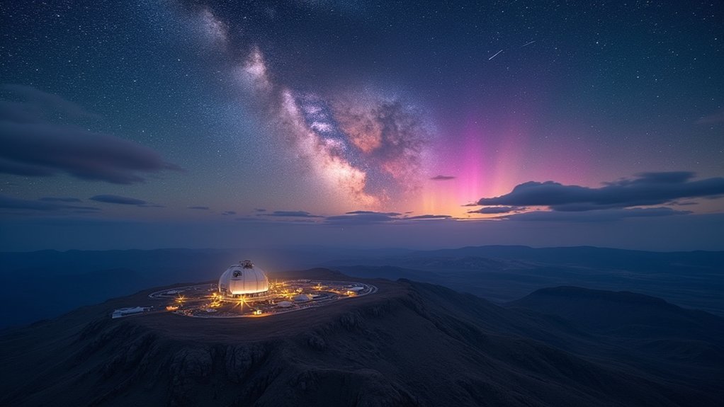
Their advanced instruments help identify areas with minimal light pollution, allowing you to locate best viewing spots for experiencing the night sky in its full glory.
These satellites feed data into sophisticated weather models that predict atmospheric stability with remarkable accuracy.
Himawari Weather Satellites: Pacific Region Sky Visibility Predictions
For stargazers in the Asia-Pacific region, the Himawari satellite constellation represents an indispensable tool for planning ideal viewing sessions.
The Japan Meteorological Agency’s Himawari-8 (launched 2014) and Himawari-9 (launched 2016) work together to provide you with unparalleled sky visibility data.
When searching for dark skies, you’ll benefit from:
- High-resolution imagery updated every 10 minutes, letting you track rapidly changing weather conditions
- Advanced Himawari Imager’s 16 spectral bands for precise cloud cover detection
- Real-time satellite imagery accessible online for immediate decision-making
- Extensive precipitation forecasts to avoid moisture-related visibility issues
Meteosat Satellites: European Weather Data for Astronomy Planning
Meteosat satellites offer extensive coverage across Europe, North Africa, and the Middle East, giving you reliable cloud forecasts essential for planning astronomy sessions.
You’ll find their data accessible through EUMETSAT’s website and various weather apps designed specifically for astronomers and stargazers.
Their advanced imaging systems provide exceptional cloud prediction accuracy up to 72 hours in advance, with detailed atmospheric transparency information that’s particularly valuable for deep-sky observation planning.
European Coverage Details
Since their initial 1977 launch, the Meteosat satellite network has evolved into Europe’s premier weather monitoring system for astronomers and stargazers.
When planning your dark sky adventures, you’ll benefit from Meteosat’s extensive coverage that spans across Europe and surrounding regions.
These satellites offer four key advantages for locating ideal viewing conditions:
- High-resolution imagery updated every 10 minutes, perfect for tracking cloud movements that might obscure deep sky objects
- Detailed atmospheric condition monitoring, helping you identify nights with superior visibility
- Precise precipitation forecasting to avoid moisture-heavy evenings that diminish seeing conditions
- Public accessibility to real-time data, allowing you to make informed decisions about when to set up your equipment
The upcoming Meteosat Third Generation launch in 2024 will further enhance these capabilities with advanced imaging technology.
Satellite Data Access
While many amateur astronomers struggle with weather predictions, accessing Meteosat satellite data provides a game-changing advantage for your stargazing plans. EUMETSAT makes this valuable information available in near real-time, allowing you to make decisions based on current conditions rather than general forecasts.
You’ll find extensive data on cloud cover, precipitation patterns, and atmospheric conditions—all vital elements for successful stargazing sessions.
The satellite’s multi-channel monitoring capabilities, including infrared and visible light observations, deliver precise information about impending weather changes that might affect visibility.
Cloud Prediction Accuracy
When planning your stargazing sessions, the remarkable accuracy of cloud predictions from Meteosat satellites can make the difference between a wasted evening and a spectacular cosmic display.
EUMETSAT’s Meteosat Second Generation delivers critical data every 15 minutes, giving you consistently updated information for your stargazing planning.
The SEVIRI technology aboard these satellites enhances your ability to anticipate clear skies through:
- Real-time monitoring of cloud formations and movements
- Short-term forecasting with notably improved accuracy
- High-resolution imagery revealing detailed atmospheric conditions
- Comprehensive coverage across Europe for reliable regional planning
You’ll benefit from these advanced imaging techniques when deciding the ideal nights for observation.
The precision of Meteosat’s cloud prediction capabilities provides you with confidence when scheduling your astronomical adventures, especially for time-sensitive events like meteor showers or eclipses.
CloudSat: Cloud Detection Technology for Optimal Viewing Windows
CloudSat’s Cloud Profiling Radar can detect clouds up to 15 kilometers high, giving you precise data about atmospheric conditions that might interfere with your stargazing.
You’ll benefit from its near-real-time information about cloud coverage and thickness, helping you identify ideal viewing windows when the night sky will be clear.
CloudSat’s Radar Capabilities
For amateur astronomers seeking perfect stargazing conditions, the sophisticated radar technology aboard CloudSat offers unparalleled insight into cloud coverage.
Operating at 705 kilometers above Earth, this satellite delivers the precise cloud intelligence you need for successful stargazing sessions.
CloudSat’s advanced radar system provides:
- High-resolution imaging that detects subtle cloud structures traditional satellites might miss
- Real-time differentiation between cloud types, helping you determine which evenings will offer clear viewing
- Accurate thickness measurements that predict how long cloud cover might persist over your location
- Atmospheric water content analysis that contributes to improved weather forecasting models
Predicting Clear Nights
The ability to predict clear nights transforms casual stargazing into consistently rewarding experiences.
CloudSat’s specialized design offers you unprecedented insight into atmospheric conditions critical for successful stargazing sessions. Its advanced radar technology penetrates cloud layers, revealing their thickness and water content—factors that directly impact visibility.
When planning your next observation, CloudSat data helps you identify ideal viewing windows by tracking cloud formation and dissipation patterns.
This satellite doesn’t work alone; it integrates with other weather monitoring systems to create detailed forecasts tailored to astronomy enthusiasts.
Weather Apps That Harness Satellite Data for Astronomers
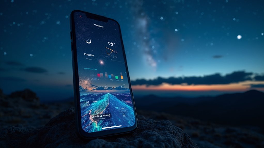
When planning your next stargazing session, weather apps powered by satellite data can be your most reliable allies.
These specialized tools transform complex satellite imagery into user-friendly forecasts tailored for astronomers like you.
Top satellite-powered weather apps for stargazing success:
Specialized satellite forecasting tools transform stargazing uncertainty into predictable night sky adventures.
- Dark Sky delivers hyper-local predictions for cloud coverage, helping you identify prime viewing windows for celestial objects.
- Weather Underground utilizes satellite data to forecast precipitation levels, essential for planning longer observation sessions.
- NOAA’s GOES-R satellite services provide real-time atmospheric condition tracking, enhancing alert accuracy for changing weather.
- NASA’s Worldview offers direct satellite imagery access, allowing you to visually track cloud systems and even monitor aurora activity when planning special astronomical event viewings.
Interpreting Satellite Imagery for Night Sky Clarity Predictions
Beyond installing weather apps, mastering how to interpret satellite imagery yourself can transform your stargazing experience. The GOES-R satellites provide real-time data that you’ll find invaluable when planning observation sessions.
| Satellite Feature | What to Look For | Impact on Night Sky |
|---|---|---|
| ABI Imagery | White cloud formations | Indicates poor visibility |
| Cloud Coverage Maps | Blue/clear areas | Prime stargazing locations |
| GLM Lightning Data | Flashing indicators | Storm activity to avoid |
| Infrared Imagery | Dark areas at night | Clear atmospheric conditions |
Learn to track the high-resolution images captured every 5-15 minutes by the Advanced Baseline Imager. When you see minimal cloud coverage on satellite imagery and no lightning activity detected by the GLM, you’ve found your window for ideal viewing conditions.
Using Satellite Data to Track Light Pollution Patterns
Light pollution poses one of the greatest challenges for modern stargazers seeking pristine night skies.
Fortunately, satellite technology now provides powerful tools to identify and avoid light-polluted areas when planning your stargazing adventures.
Several satellites offer valuable light pollution tracking capabilities:
- Suomi NPP collects nighttime light data, creating detailed maps that show where artificial lighting impacts visibility.
- NOAA’s GOES-R series provides real-time atmospheric imagery that complements light pollution data for thorough stargazing forecasts.
- ESA’s Sentinel satellites analyze urban light emissions through the Copernicus program, helping you identify darker observing locations.
- Light pollution monitoring systems combine multiple satellite datasets to generate up-to-date maps showing the best locations for telescope setup.
Combining Multiple Satellite Sources for Accurate Stargazing Forecasts
Although dedicated astronomers can interpret data from individual satellites, combining multiple satellite sources creates a substantially more reliable forecasting system for your stargazing plans.
Multi-satellite data integration provides superior reliability for astronomical forecasting and observation planning.
When you integrate real-time data from NOAA’s GOES-R series (transmitting at 5 MB/s) with NASA’s MODIS imagery, you’ll dramatically improve your ability to predict cloud cover and atmospheric conditions.
For best results, access National Weather Service satellite imagery to identify clear sky regions by analyzing cloud patterns across your area.
Platforms like Clear Dark Sky aggregate this multi-satellite data, providing specific recommendations for viewing times.
Consider supplementing these forecasts with Sentinel-2’s high-resolution imagery for hyperlocal accuracy.
Future Weather Satellites and Their Benefits for Amateur Astronomy
The next generation of weather satellites, including GOES-U, will revolutionize your stargazing experience with enhanced data transmission speeds up to 5 MB/s.
You’ll benefit from improved cloud cover predictions and visibility forecasts, allowing you to plan observation sessions with greater confidence.
Advanced instruments like the Geostationary Lightning Mapper will help you avoid areas with severe weather conditions, ensuring your telescope equipment remains safe while maximizing clear-sky viewing opportunities.
Upcoming Satellite Technology
As we peer into the future of weather monitoring, satellite technology promises to revolutionize how amateur astronomers plan their stargazing sessions.
The upcoming GeoXO satellite program will transform stargazing conditions with real-time atmospheric data and high-resolution imaging.
Here’s how future satellites will enhance your astronomy experience:
- The GeoXO series (late 2020s) will predict cloud cover with unprecedented accuracy, helping you choose ideal viewing nights.
- GOES-U’s CCOR-1 instrument will provide solar data that directly impacts nighttime sky conditions.
- Machine learning integration will deliver faster, more precise clear-sky predictions for planning stargazing events.
- Enhanced data transmission rates will send you timely alerts about sudden visibility changes.
You’ll soon have professional-grade weather forecasting tools right at your fingertips.
Enhanced Prediction Capabilities
Looking beyond just better visuals, tomorrow’s weather satellites will fundamentally transform how stargazers predict ideal viewing conditions. The upcoming GOES-U satellites will transmit data at 5 MB/s, revolutionizing your stargazing planning with unprecedented accuracy.
| Feature | Benefit | Impact on Stargazing |
|---|---|---|
| 5 MB/s Data Rate | Faster updates | Real-time viewing decisions |
| Geostationary Lightning Mapper | Storm tracking | Avoid cloudy areas |
| High-resolution Imaging | Precise cloud monitoring | Better location selection |
| Enhanced data capabilities | Meteor shower predictions | Optimized viewing times |
| Improved forecasting tools | Weather pattern analysis | Minimize disruptions |
These enhanced prediction capabilities mean you’ll waste less time on unsuccessful outings. You’ll know exactly when and where to set up your telescope, maximizing your chances of witnessing spectacular celestial events without weather interference.
Frequently Asked Questions
What Are the Best Weather Conditions for Stargazing?
For ideal stargazing, you’ll want clear skies with less than 40% cloud cover, low humidity, cool temperatures, minimal moonlight during new moon phase, and calm winds to avoid atmospheric turbulence.
What Is the Most Accurate Stargazing App?
SkySafari 7 Plus is your most accurate stargazing app, with its 2.5 million stars database. You’ll also find Star Walk 2, PhotoPills, and Sky Guide excellent alternatives with real-time AR tracking capabilities.
How Do You Know if It’s a Good Night for Stargazing?
You’ll know it’s a good night for stargazing when you check for clear skies with minimal cloud cover, low humidity, no moon or a new moon, and calm winds without atmospheric turbulence.
What Is the Best Weather to See the Stars?
You’ll see stars best on clear, moonless nights with less than 40% cloud cover. Look for cold, dry conditions with light winds. Low humidity reduces atmospheric turbulence, giving you sharper views of celestial objects.
In Summary
You’ll maximize your stargazing by leveraging these satellite systems together. Don’t rely on just one source—combine GOES-R’s real-time imagery with NOAA’s detailed forecasting and specialized tools like CloudSat. Track both weather patterns and light pollution using available satellite data. As technology advances, you’ll gain even more precise forecasting tools. With these resources at your fingertips, you’re well-equipped to find those perfect clear nights for stellar observations.


Leave a Reply